
If you look round on the Internet you will find some reference to the Barden Triangle. The Barden Triangle consists of Troller's Gill, Dibble's Bridge and Elbolton Hill. I decided in my recent break in the Dales to walk the Triangle and see for myself if any of the legends might be true.
The day I walked the triangle, Wednesday, the day after walking to the Strid, I was lucky in respect to the weather. It was sunny, but a bit on the cool side, which made ideal conditions for the near 14 miles I was about to walk. I left Appletreewick heading east round to Skyreholme Village.
 |
| Sunny weather as I left Appletreewick. |
As you pass through Skyreholme you see signs for Percival Hall which should be followed. At the other side of Skyreholme you approach Percival Hall where there is a gate on the left of the narrow road. Next to the gate is a very small sign showing the direction to Troller's Gill. The path meanders along the side of the gill on a steady uphill grade with the occasional muddy area to keep you on your toes.
 |
| The Gill on the way up to the valley. |
As you work your way up into the valley through the pass it really starts to open up in front of you. There is a feeling of seclusion as you make your way further in.
 |
| Near to the top of the path. |
After walking for about five to ten minutes, at the top of the pass, you come to a high stile with a strange looking structure in front of you. Not what I would expect in this location. As you come up to the top of the feature it becomes evident that there is possibly a man made structure here. It turns out that this used to be the Skyreholme Dam that supplied water to a paper mill in the village. That is until the dam burst it's banks in 1899 and evidently was never repaired.
 |
| The former Skyreholme Dam. |
The path continues on from the dam further back into the valley. The walk is very pleasant with some very picturesque features. I would highly recommend the location for a picnic, although it should be remembered that much of this area is protected and there is a large amount of wildlife that needs considering.
 |
| The pass opens into a picturesque valley. |
If you continue to work your way around to the back of the valley you will come to Troller's Gill. It's a good idea, when near the gill, to be aware of the weather as it is possible for the gill to rapidly fill up in heavy rain. There are also a couple of myths associated with Troller's Gill. The first, that Trolls live in the Gill and will through stones down at you if you attempt to pass through are the source of it's name.
 |
| Troller's Gill. |
There is also said to be a cave near the Gill that is haunted by a wild dog. This 'barguest' known as the 'spectre dog of Craven' is generally a popular myth in many areas of the north, although with a different name. As I back stepped slightly from Troller's Gill to make my way up to the New Road I came across an old abandoned lead mine. There are several caves making up the mine. The cave that is the source of the wild dog could well be one of these in the photos I took. The caves in the second photo were particularly creepy as in this area it becomes very quite. I have to say, I didn't hang around for long after I took some photos.
 |
| First lot of smaller caves. |
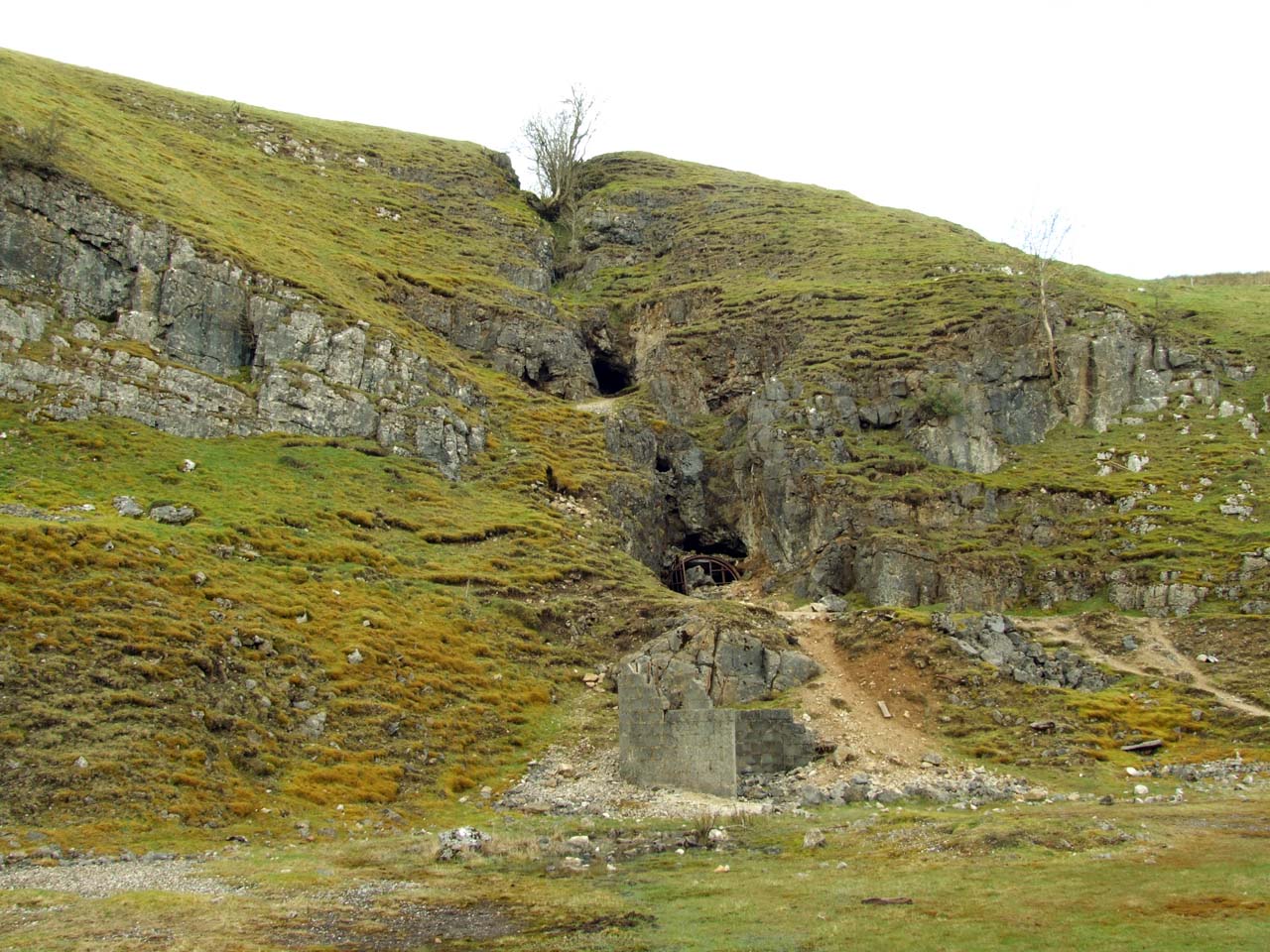 |
| These caves creeped me out. |
The path continues to wind up above the caves and up to the New Road near Hell hole. As you come to the road you can work your way about a quarter of a mile to the southwest where you come to a road/path that will take you north in the direction of Grimwith Reservoir about a mile away. Once at the reservoir you can follow the path southwest towards Dibble's Bridge. The bridge is infamous as the sight of a fatal coach crash in 1975 (RIP). The bridge, also known as Devil's Bridge, is said to have been built by the Devil for a cobbler from Thorpe who was having difficulty getting to Fountains Abbey with repaired shoes.
 |
| Dibble's Bridge. |
The path from the side of the bridge heads south on the east side of the River Dibb. Care must be taken as the path proceeds high to your left away from the river bottom where access is not permitted. The path becomes a little vague, but basically I would head to pastures high on the field to your south where signs and stiles for the path are picked up. A mile and half from Dibbles Bridge you come to a cross roads. Taking the path off to the right allows you to work your way down to Burnsall which is in the valley below.
 |
| In the distance are the hills above Burnsall, Elbolton Hill can be seen to the right (the darker small hill). |
Burnsall is a really nice looking village with what I think is a very 'Dales' look. After coming into Burnsall you can then proceed onto the Dales Way by joining it along the side of the Red Dragon pub. The Red Dragon is directly next to the bridge which is the dominant feature of the village and crosses the river Wharfe.
 |
| Burnsall's bridge across the Wharfe. |
You follow the Dale's Way for about a mile north to Hebden suspension bridge. Along the way you pass Wilfrid Scar and Loup Scar on the river's east bank. Loup Scar in particular is very dramatic.
 |
| Loup Scar. |
Once at Hebden Bridge you turn left up the hill to Thorpe about a mile to the west. As you arrive in Thorpe you can see Elbolton Hill to the northwest.
 |
| Elbolton Hill. |
The path which travels southwest from the village passes around the southern side of the hill and continues westward. There is no set path up Elbolton Hill, it is in an open access area (under the CROW Act) so it is possible to find your own way up the hill. This has to be down to personal preference. The hill is not particularly high, about 150 feet from the path to peak. But it is very steep, so care should be taken as a fall would be all the way to the bottom.
 |
| My chosen route. |
Once at the top you will find a Cairn, a few interesting features and some fantastic views of the area. I could see Grassington, some of the larger hills in the northern part of the Dales, Appletreewick, Simon's Seat etc. Quite spectacular. And one big surprise, my mobile phone managed to lock onto a BT Openzone right up there. Unfortunately though, no fairies. There is a myth that fairies live on Elbolton Hill, but none were spotted today.
 |
| The Cairn on Elbolton Hill. |
I proceeded carefully back down the hill and into Thorpe Village. Just out of the village is a path which links directly back down to Burnsall and from Burnsall on to Appletreewick.
 |
| Part of the path which directly links Thorpe to Burnsall. |
This was an absolutely fantastic walk. some very interesting things to see and a good mix of terrain. Definitely one I would highly recommend, and there are alternate routes that could be taken to make the walk longer if desired. It's also important to remember that this walk has some tricky parts and care should be taken. Be safe out there!


this walk looks great. Where can I get a map for it?
ReplyDeleteI haven't seen a specific map for the walk. I was told about the Barden Triangle by someone in the area. When I got home I looked up the three places and mapped a route on Ordnance Survey map OL2, The Yorkshire Dales South and Western area. The route is fairly straight forward, but can be muddy at times in certain spots.
DeleteAre you an experienced walker?