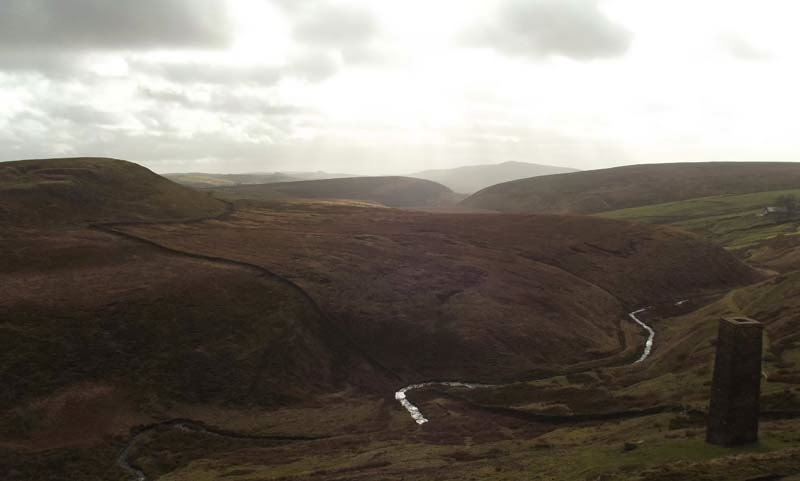
Incorrectly there is a myth that Wildboar Clough acquired it's name due to being the last place where a wild boar was killed in England. What it definitely is, is the place where I started my walk last weekend with the aim of taking in Three Shire Heads. It was also the muddiest walk I have ever undertaken. Any wild boar would have been happy, almost as happy as pigs in mud.
The car park at the northern end of Wildboar Clough is free. But there are no bins, so take your rubbish home. But I'm more than happy to for free parking.
The path I chose as a hundred yards or so back down the road from the car park.
This is a nice section that takes you around the back of a plantation over looking Crag Hall to the East and Shutlingsloe, a 506 meter peak to the west. I will be coming down here again at some point to do a route taking in Shutlingsloe. For now, I had a planned route to stick to. (When I walk alone I always leave a route plan and times with someone. Any deviation could be potentially dangerous for me. So I stick to my plans where it is practical to do so.)
From the plantation I headed down into the valley to cross the bridge over Clough Brook and in the direction of Berry Bank Farm.
Looking back there was a great view of Wildboar Clough and signs that the weather was definitely on the up with blue skies and diminishing clouds.
The path continues over a rise and weaves through a few fields where use of an OS map is really needed. The map is spot on to the field layout and will make working your way through this section a lot easier. At this point you cross the A54 and around the foot of Tagsclough Hill with Heild End Farm on your right. This section offered some f the nicest views of the day with the weather really giving it's best for the first time in a while.
The path drops down towards Burntcliffe Top and across a road. From here the path becomes quite steep, which has been pathed in places, although the lower section heading into the valley bottom is very steep with Gauze either side. At this point my route changed from a roughly south-easterly direction to a north-easterly along the River Dane.
At Manor Farm the path continues north-easterly and I am following the Dane Valley Way, all signposted as DVW. This is where the mud began, and didn't really end, on and off, for 2-3 miles.
Around a kilometre north east of Manor Farm, the path comes to a cross roads. At this point I turned left around the foot of Turn Edge with Three Shire Heads on the eastern side of Cut-thorn Hill in front of me. Three Shire Heads is the point at which three shires; Cheshire, Staffordshire and Derbyshire meet.
The path eventually works it's back to the River Dane and the very picturesque Packhorse Bridge. I'm going to have to come here some time in the summer to try and get some better photographs. But even with a lack of greenery, it's still a nice location to visit.
Continuing north, up by the River Dane, the path is dry for a while. But eventually that ends and it quickly becomes a quagmire. Someone has installed pathing slabs of stone in places, but to be honest, they don't help at all. The mud is deep, but passable with care. Just expect to get dirty.
After just over a kilometre from the Packhorse Bridge you pass through the Danebower Quarries with the path working it's way back up to the A54.
Working my way up the slope I looked south to be greeted with a view that was just clouding over a little. But to my dismay I could see the Roaches clearly, no low cloud, no rain, they were clearly visible. Those Roaches really have it in for me. I wonder if I'd gone there instead if the weather would have been different.
Crossing the A54 brings you onto a really nice path that is like walking on a carpet after the experience on the Dane Valley Way. I followed this path for around a kilometre with some incredible views off to the west and south west. Shutlingsloe came back into view with Jodrell Bank radio telescope visible.
At about one kilometre along the path there is a turn off to the left that takes you down and along Cumberland Brook.
The brook widens with a plantation along it's banks. The path here was neither path, nor stream, but a combination of both. It is, however, another extremely picturesque area worthy of a few photographs.
At the foot of the plantation the path breaks out onto the road and back into the car park at Wildboar Clough. This is a highly recommended location for a walk. It may have been extremely muddy in places, but it was worth it.


No comments:
Post a Comment