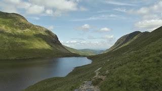
Have you ever had a particular summit in mind and ended up finding something better in the process? I have. I’d spotted St Sunday Crag (841m) while heading up Helvellyn earlier in the year. St Sunday Crag has a bit of reputation for the crags on its North West flanks; the Chockstone Gullies and Pinnacle Ridge. I decided I had to give it a go.
My route, like quite a few lately began in Glenridding, in the notorious ‘Easy Park’ car park there. To be honest, I haven’t had a problem with the car park. Just make sure that as soon as you have paid…..leave. That way you reduce your chances of them sending you a bill for over staying.
From the car park you head east following the main road to Patterdale till you come to the ‘Lane to Grisedale’. It’s literally called that on the sign, just over half a mile or so from Glenridding on the right.
Just over a third of a mile up the lane you will see an opening in the trees at the side of the road, on the left with a footpath sign. This is the footpath that leads to the foot of and up Thornhow End.
The initial section up Thornhow End I found to be the toughest of the day. Possibly because my legs hadn’t got warmed up, but this section is fairly steep and gets the lungs and heart working.
On the way up Thornhow End you can see the route up to Helvellyn and the back of Striding Edge. I find it important to keep looking around on my way up anywhere to make sure I don’t miss a great view.
Once past Thornhow End the path headed along the edge of Birks with the summit of St Sunday Crag coming into view around Blind Cove. The path is a little friendlier on the legs now, more a steady stroll, well not quite, but much easier.
There is also a great view now of Ullswater and the surrounding hills. And the weather was still holding, quite a feat in the Lakes.
The final climb up onto St Sunday Crag involves a little mild scrambling, but it adds a bit of variety and interest to what could have ended up being just an uphill slog. The views from the summit are quite spectacular and worth hanging around for to rest and take in.
Then it’s onward, and upward. There is a little downhill first, but off in the distance is what I thought was the ‘pis de la resistance’ of the walk, Cofa Pike (823m). It’s quite difficult to spot nestled against Fairfield (873m) behind it, but it’s there if you follow the ridge off to the right of the photo below to the first rocky outcrop.
On the way there I was given a fantastic view of Striding Edge. This opens your eyes to the drop below the edge. Something you need to be aware of if you have a go. From the top of Striding Edge down into Nevermost Cove is a drop of around 800 feet.
As you head out onto the ridge the outline and scale of Cofa Pike becomes clearer. I’ve seen photographs of Cofa Pike, and none of them, mine included, do it justice. I like these compact, rocky Pikes that offer far more interest than a 2000-3000 foot bump.
Looking back and St Sunday Crag, while not just a bump, looks very benign, especially when you can’t see the crags on the opposite side.
When the walk across the adjoining ridge meets Cofa Pike, up close and personal, the character of this little peak makes itself known. The surface is quite gnarly, but there is a path up to the top. It’s not particularly difficult, but it does get a little exposed in places, with some loose rocks to keep you on your toes.
From the summit of Cofa Pike and there is amazing view down into Grisedale and across to Striding Edge, with Eagle Crag (looks interesting) in front.
There’s also a nice view down on Red Tarn and the root of my return route to Glenridding.
Once across on to the flanks of Fairfield a look back reveals the rocky peak of Cofa Pike. I chose to go across the crest of the summit rather than follow the path that edges around these little scrambles. I think this is where I really started to find I prefer to be a little off piste.
After a few photographs on the summit of Fairfield, which really ought to be renamed Fairview I followed the path down to Hause Gap. This steep path really needs some respect if going down. There are a lot of loose stones waiting for you to slide on, so be careful. There’s also a great view of Dollywaggon Pike across the valley.
Once at Red Tarn it’s onto the path that heads down through Grisedale and back to Glenridding.
The walk through the valley is really nice, with great views of the crag on the North West side of St Sunday Crag. Somewhere up there is Pinnacle Ridge, something I would really like to have a go at sometime.
Down at the Crossing Plantation and the effects of the weather conditions on the trees in the valley is clear.
The walk back into Glenridding is just the reverse of the initial approach up Grisedale lane once you reach the road section. This was a great day out.


No comments:
Post a Comment